- Home ›
- NZ National Parks ›
- Mount Aspiring National Park
Mount Aspiring National Park New Zealand
The Mount Aspiring National Park covering 3,555 square kilometres is also part of Te Wahipounamu / Southwest New Zealand World Heritage Area.
Straddling the Southern Alps, the Park was established as the country's 10th National Park in 1964 and named after one of the highest peaks in New Zealand.
If you love mountains, glaciers, alpine lakes, and river valleys, you will think this National Park is paradise!
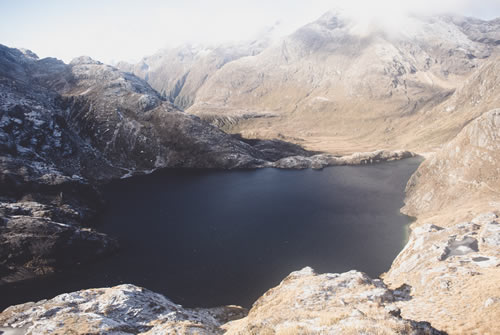
Image by Aleks Dahlberg
Long before the naming and mapping of the geographical features of Mount Aspiring National Park, Maori would have travelled through this region in order to reach the pounamu fields (Greenstone). You will also see evidence of farming and mining left behind by the settlers that tried to make a living in this region over the years.
The nearest main towns are Queenstown, Wanaka, Glenorchy, and Te Anau, with Haast and Makarora also being available for accommodation.
There is a location map of the national park at the bottom of this page.
Activities in Mount Aspiring National Park
There are some fantastic rivers in this national park where you can get jet boat trips such as the Wilkin, the Dart, and the Matukituki rivers. Heli skiing is also an exceptional choice for adventure experiences in locations such as Albertburn and Northern Buchanans.
With a combination of mountains and valleys, rivers and wilderness, it provides a setting for walkers and trampers to spend hours or days pursuing something they love doing through forests dominated by beech trees. Being an unpredictable environment it is advised to take note of the New Zealand safety code, be aware of local weather conditions before you set out, and ensure you take care.
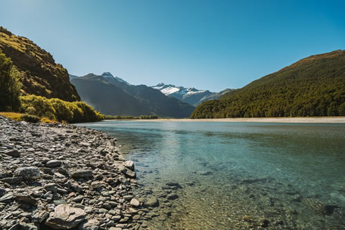
Image by Koon Chakhatrakan
Mount Aspiring National Park and Fiordland National Park are the home of the famous Routeburn Track and during the summer months you can walk across mountain passes between valleys. The Routeburn Track is a three day tramp that runs between a road and a lake, the Te Anau to Milford Road (SH94) and Lake Wakatipu. Related pages are Fiordland National Park and Great Walks.
Another walk that takes five days to complete is the Rees-Dart Track in the southern end of Mount Aspiring National Park following the Rees River and Dart River.
Short walks from Makarora and Wanaka are very popular and include the one and half hour Aspiring Hut walk and the one and half hour Rob Roy track.
If you are looking for mountaineering opportunities, you can choose from a variety of challenges such as Mt Aspiring and Mt Awful. Instruction and guides are both available from local companies if required and are recommended.
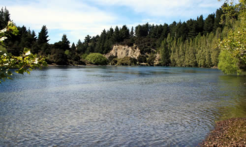
River by Lake Wanaka. South Island, New Zealand
NZ National Parks
Find a list of all the parks at New Zealand National Parks.
Accommodation in Mount Aspiring National Park
Around the Park you will find plenty of camp sites, bed and breakfast, farm stays, and chalets.
Settlements to look out for accommodation will be Haast, Glenorchy, and Makarora, Wanaka, Queenstown, and Te Anau.
To find accommodation within the Mt Aspiring National Park you are really only looking at the various huts provided by the Department of Conservation and that are dotted along the major walks.
On the Routeburn Track for example, there are two ‘Great Walk’ huts available. Some tracks will also have camping areas as well as huts but the huts do need to be booked in advance during the height of the summer season, you will be disappointed if you turn up at a hut and expect it to be available without booking in the high season.
Haast Pass, in the north eastern side of Mount Aspiring National Park, is the main route across these Southern Alps in this region.